Terrain and Stereo
Technical Guides & other documentation
TERRAIN AND STEREO
Applications: Making Topographic Maps
(13 pp)
Color Relief Shading
Computing Topographic Properties
Create DEMs from Text Files
Deriving Complex Composite Viewsheds
(2 pp)
Methods for Computing Topographic Properties
Relief Shading
Surface Properties
Terrain Operations
Tutorial: Analyzing Terrain and Surfaces
(20 pp)
Lidar Manager
Auto-Linking to LAS Point Clouds
Automatically Classify LAS Point Clouds
(2 pp)
Automatically Classify Noise in LAS Point Clouds
(2 pp)
Classify Ground Points by Multiscale Curvature
(2 pp)
Classify Ground Points by Terrain Following
(2 pp)
Comparing Automatic Classification Results
(2 pp)
Extract Lidar Points by Area, Class, Return Type
LIDAR
Manage Lidar Point Clouds
(2 pp)
Merge and/or Tile Lidar Point Clouds
Use LAS Files as Single Seamless Dataset
(2 pp)
Stereo
1-meter Stereo of Anywhere in the USA
10-meter Stereo of anywhere in the World
Anaglyph Stereo Viewing
Creating a Full-Color 3D Video from a TNTmips Stereo Vi ...
(2 pp)
Drawing Tools Follow Terrain
Inexpensive Hardware for Full Color TNT Stereo
(2 pp)
Interpret Features for any Global Area
Move Beyond 1492
Overlay Your Geodata in Google Earth
Posting and Configuring a 3D Video on YouTube
Print Anaglyph Stereo Images
Sketch Over Your Tileset in Google Earth
Stereo Display Settings
Stereo Viewing
Use Any Popular 3D Display Method
(2 pp)
View Geodata in Stereo in 2D Views
(2 pp)
Web Terrain Structures
Surface Modeling
Surface Modeling
Tutorial: Surface Modeling
(28 pp)
Watershed
Create Segmented Flowpaths
DEM Quality Determines Watershed Accuracy
(2 pp)
Fill or Drain Depressions in DEMs
(2 pp)
Flowpaths and Basins from Seed Points
Geomorphic/Hydrologic Characteristics of DEMs
Hydrologic Attributes of Catchments
Hydrologic Attributes of Flowpaths
Tutorial: Modeling Watershed Geomorphology
(28 pp)
Watershed Analysis
Watershed Flowpath and Basin Thresholds
(2 pp)
Terrain and Stereo
Applications: Making Topographic Maps
Terrain and Stereo
Color Relief Shading
Terrain and Stereo
Computing Topographic Properties
Terrain and Stereo
Create DEMs from Text Files
Terrain and Stereo
Deriving Complex Composite Viewsheds
Terrain and Stereo
Methods for Computing Topographic Properties
Terrain and Stereo
Relief Shading
Terrain and Stereo
Surface Properties
Terrain and Stereo
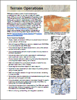
Terrain Operations
Terrain and Stereo
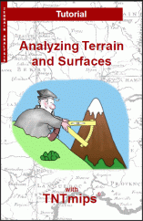
Tutorial: Analyzing Terrain and Surfaces
Lidar Manager
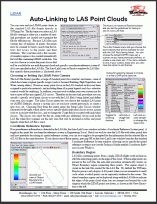
Auto-Linking to LAS Point Clouds
Lidar Manager
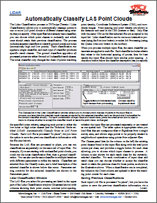
Automatically Classify LAS Point Clouds
Lidar Manager
Automatically Classify Noise in LAS Point Clouds
Lidar Manager
Classify Ground Points by Multiscale Curvature
Lidar Manager
Classify Ground Points by Terrain Following
Lidar Manager
Comparing Automatic Classification Results
Lidar Manager
Extract Lidar Points by Area, Class, Return Type
Lidar Manager
LIDAR
Lidar Manager
Manage Lidar Point Clouds
Lidar Manager
Merge and/or Tile Lidar Point Clouds
Lidar Manager
Use LAS Files as Single Seamless Dataset
Stereo
1-meter Stereo of Anywhere in the USA
Stereo
10-meter Stereo of anywhere in the World
Stereo
Anaglyph Stereo Viewing
Stereo
Creating a Full-Color 3D Video from a TNTmips Stereo Vi ...
Stereo
Drawing Tools Follow Terrain
Stereo
Inexpensive Hardware for Full Color TNT Stereo
Stereo
Interpret Features for any Global Area
Stereo
Move Beyond 1492
Stereo
Overlay Your Geodata in Google Earth
Stereo
Posting and Configuring a 3D Video on YouTube
Stereo
Print Anaglyph Stereo Images
Stereo
Sketch Over Your Tileset in Google Earth
Stereo
Stereo Display Settings
Stereo
Stereo Viewing
Stereo
Use Any Popular 3D Display Method
Stereo
View Geodata in Stereo in 2D Views
Stereo
Web Terrain Structures
Surface Modeling
Surface Modeling
Surface Modeling
Tutorial: Surface Modeling
Watershed
Create Segmented Flowpaths
Watershed
DEM Quality Determines Watershed Accuracy
Watershed
Fill or Drain Depressions in DEMs
Watershed
Flowpaths and Basins from Seed Points
Watershed
Geomorphic/Hydrologic Characteristics of DEMs
Watershed
Hydrologic Attributes of Catchments
Watershed
Hydrologic Attributes of Flowpaths
Watershed
Tutorial: Modeling Watershed Geomorphology
Watershed
Watershed Analysis
Watershed
Watershed Flowpath and Basin Thresholds